As a GIS professional, I am deeply passionate about the power of geographic information systems to transform the way we understand and interact with the world. GIS is more than just mapping—it is a tool for uncovering patterns, solving complex problems, and making data-driven decisions that can improve lives.
What excites me most about GIS is its ability to bridge the gap between data and action. Whether it’s predicting crime patterns to enhance public safety, mapping environmental changes to combat climate change, or optimizing transportation networks for more efficient cities, GIS empowers decision-makers with the insights they need to make meaningful changes.
Beyond its technical applications, GIS fuels my passion for storytelling. Every dataset tells a story about people, places, and trends, and GIS allows us to visualize and communicate these stories in ways that inspire action. Whether it’s responding to disasters, improving urban planning, or addressing social inequities, GIS has the power to create a more just, informed, and sustainable world.
At its core, GIS is about understanding our surroundings and making a difference. Being part of this field means contributing to something larger than myself—helping humanity navigate challenges, make informed choices, and build a better future. That, to me, is what makes being a GIS professional so fulfilling.
Credentials

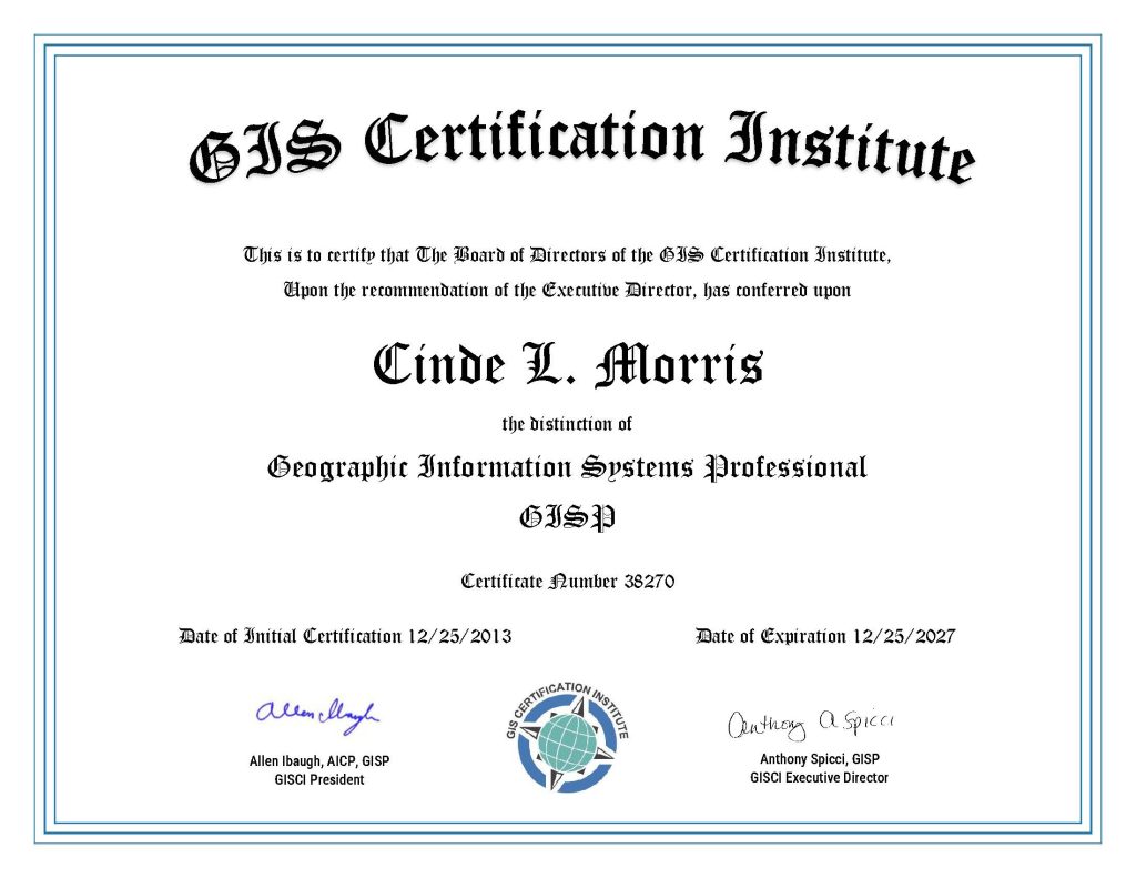
I have been a Geographic Systems Professional (GISP) since 2013.
The GISP certification is administered by the GIS Certification Institute (GISCI).
Achievements
- ESRI Special Achievement Award – 2009 – “Mapping the Fargo flood.”
- ESRI Special Achievement Award – 2012 – “Mapping the North Dakota oil boom.”
Giving Back
- GIS Corps Volunteer
- Certified Forest Therapy Guide – give free forest bathing walks
- Volunteer – White Bear Lake Certified Emergency Response Team Member
- Mentor at MN GIS/LIS Consortium Conference
- Phoenix Area Rottweiler Rescue Volunteer
- Fargo-Moorhead Derby Girls – Head of Charity
